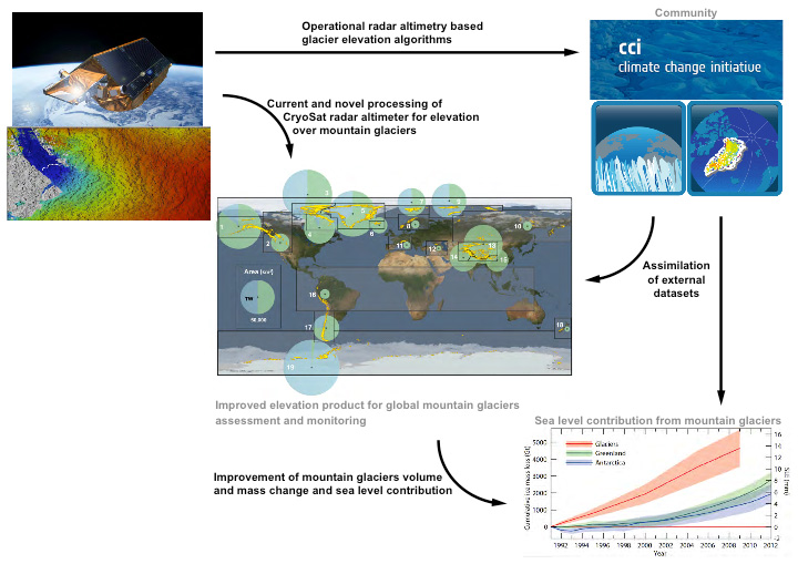
 The aim of this project is to generate measurements of elevation changes across the world’s mountain glaciers’ using CryoSat observations and to scientifically exploit these results to determine their mass balance and sea level contribution, in compliance with the statement of work and as a secondary objective of the CryoSat mission. Knowledge of mountain glacier topography and its change over time is a basic parameter of glaciological research, and has been identified by GCOS and by IPCC as a major shortcoming of the current observational capability because there is currently no demonstrated system that can routinely monitor glaciers in rugged mountainous terrain.
Mountain glaciers are retreating worldwide, and are a major contributor to current non-steric sea level change. This ice loss poses a threat to coastal regions and to a large fraction of the world’s population that rely on access to fresh water or are exposed to glaciers-related risks which tends to increase with increasing melting. The six region of interest (i.e. high-mountain Asia, Pacific Coast range, Rocky Mountains, the Antarctic Peninsula, the Southern Andes, and the Canadian Arctic) represent over 50% of the total area covered by the world’s mountain glaciers and over 50% of the mean Sea Level Equivalent; they are geographically distributed, representative of a diversity of local and climatic conditions.
Annual mass loss for these 6 regions total 152 Gt.yr-1, a majority of the total loss of 260 Gt.yr-1 when considering all the glaciers worldwide.